Traffic Data
Traffic Data and Travel Time are represented along with Traffic Detectors by the icon on the action panel. You can use the ATMS to:
- View current data from probe data sources such as Bluetooth or commercial data providers
- View Travel Time Routes and their current travel times
Map layers for each of the traffic data sources in the system can be turned on using the Map Layers control. See section Map Layers for details.
Current Traffic Conditions
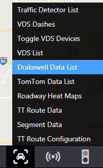
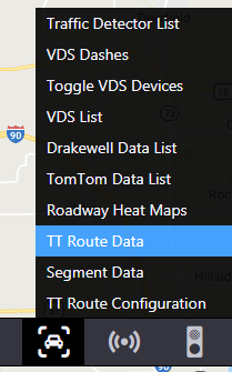
The current conditions reported by each traffic data source can be accessed from the Traffic Data menu accessed by right-clicking on the icon on the Action Panel.
Drakewell
To access current Drakewell Bluetooth data, select the Drakewell Data List option from the Traffic Data menu.
For each segment configured in ATMS, the system reports:
- Polled Time : time the data was retrieved
- Travel Time : the current travel time for the segment as reported by Drakewell
- Normal Travel Time : the normal travel time for this time interval, as reported by Drakewell
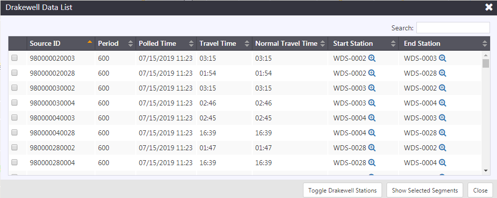
To show or hide the Drakewell stations on the map, click Toggle Drakewell Stations.
To find the location of a Drakewell source, click the checkbox next to the Source ID(s) of the segment(s) you wish to investigate and click Show Selected Segments. The selected segments will be displayed on the map, color coded based on their current reported speed. Use the buttons to center the map on either the start or end station of the segment.
Inrix
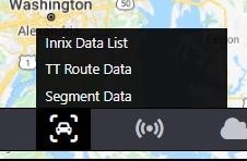
To access current Inrix data, select the Inrix Data List option from the Traffic Data menu.
For each segment configured in ATMS, the system reports:
- Speed (MPH) : the segment speed at the time polled
- Historic Speed (MPH) : the historic average speed of the segment
- Reference Speed (MPH) : the reference speed of the segment
- Polled Time : time the data was retrieved
- Score : the score reported by Inrix
- Confidence : the confidence reported by Inrix
- Travel Time : the current travel time for the segment as reported by Inrix
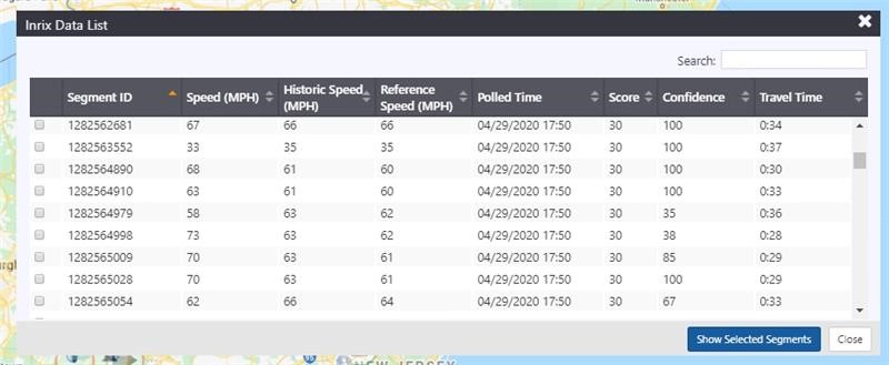
To find the location of an Inrix source, click the checkbox next to the Source ID(s) of the segment(s) you wish to investigate and click Show Selected Segments. The selected segments will be displayed on the map, color coded based on their current reported speed.
Inrix segments can also be viewed on the map. Right click on the map and Select Show Nearby Inrix Segments to open windows naming any nearby Inrix segments. If there are multiple nearby segments, multiple windows will open stacked on top of each other. Drag them to see the windows below the top window.
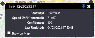
The Inrix Segments window names the segment in the title bar and displays:
- Roadway: The name and direction of the roadway for the associated Inrix segment.
- Speed (MPH) (normal): The current segment speed in miles per hour, and in parentheses the typical segment speed (for that day and time) in miles per hour.
- Confidence: The confidence level up to 100 of the associated Inrix segment. It is based on the number of traversals and the time range since the last traversal and is for internal use only.
- Last Updated: The date and time the associated Inrix segment was last updated.
- Show on Map: Check this box to display the Inrix segment on the map.
TomTom
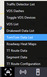
To access current TomTom traffic data, select the TomTom Data List option from the Traffic Data menu.
For each segment configured in ATMS, the system reports:
- Average Speed (MPH)
- Travel Time
- Confidence : the confidence reported by TomTom
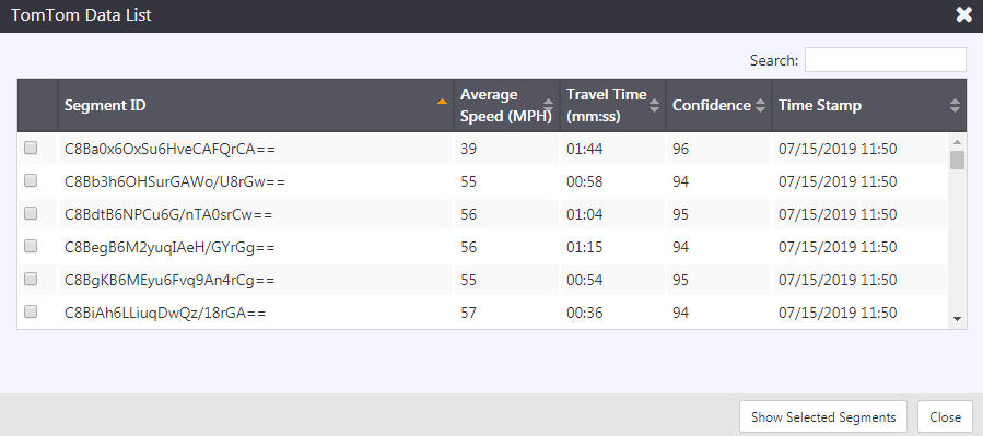
To find the location of a TomTom segment, click the checkbox next to the Segment ID(s) of the segment(s) you wish to investigate and click Show Selected Segments. The selected segments will be displayed on the map, color coded based on their current reported speed.
Bluetooth Reader Segments
To access current Bluetooth segments, select the Bluetooth reader Segments option from the Traffic Data menu.
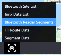
For each segment configured in ATMS, the system reports:
- Speed (MPH), Reference Speed (MPH)
- Polled Time
- Confidence
- Travel Time(seconds)

To find the location of a Bluetooth reader segment, click the checkbox next to the Segment ID(s) of the segment(s) you wish to investigate and click Show Selected Segments. The selected segments will be displayed on the map, color coded based on their current reported speed.
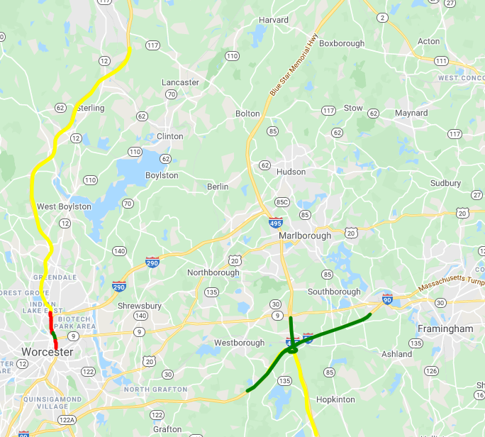
Travel Times
The ATMS computes travel times for a configured set of routes based on the data reported from all available traffic data sources. Current travel times for each configured route and their associated segments can be accessed by right-clicking on the icon on the Action Panel View
Travel Time Route List
To access the Travel Time Route list, select the TT Route Data menu option from the Traffic Data menu.
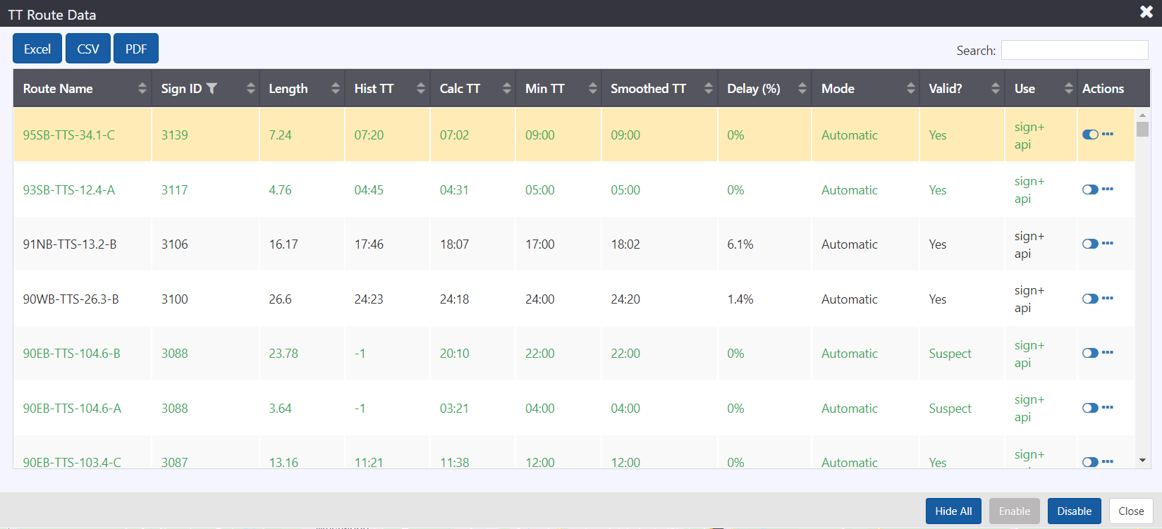
The list provides the following for each route:
- Route Name: The name of the travel time route
- Sign ID: The ID number for the travel time route's sign
- Length: Route length in miles
- Hist TT: The historical average travel time for this time of day and day of week
- Calc TT: The travel time calculated based on data collected in this time interval
- Min TT: The minimum travel time configured for the route
- Smoothed TT: the travel time calculated from the past n collection cycles, based on configured smoothing values
- Delay %: The delay between calculated and minimum travel time
- Mode: Indicates whether the route is Enabled (Automatic) or Disabled
- Valid: indicates if the route is valid. For a route to be valid it must have a minimum percentage of its length covered by valid route segments, and be less than a maximum travel time configured for the route.
- Use: Indicates where data from this route is used
- API: this route is published to external systems using the ATMS API
- Sign: this route is included in travel time messaging for a sign
- HAR: this route is included in the HAR travel time broadcast
Each row is color-coded to indicate the state of the route:
- Green: Travel time is at or below minimum travel time (free-flow conditions)
- Black: Travel time is above minimum but less than maximum for route
- Red: Route is invalid, either due to lack of data coverage or excessive travel time
Each row contains two buttons: and
. The
button toggles the route to be displayed on the map. The
button which opens a menu of other actions for the route.
The actions include:
- Toggle Mode: Enables or Disables a route
- Segment Details: Opens a list of the roadway segments that make up the route
View Travel Time Route Segments
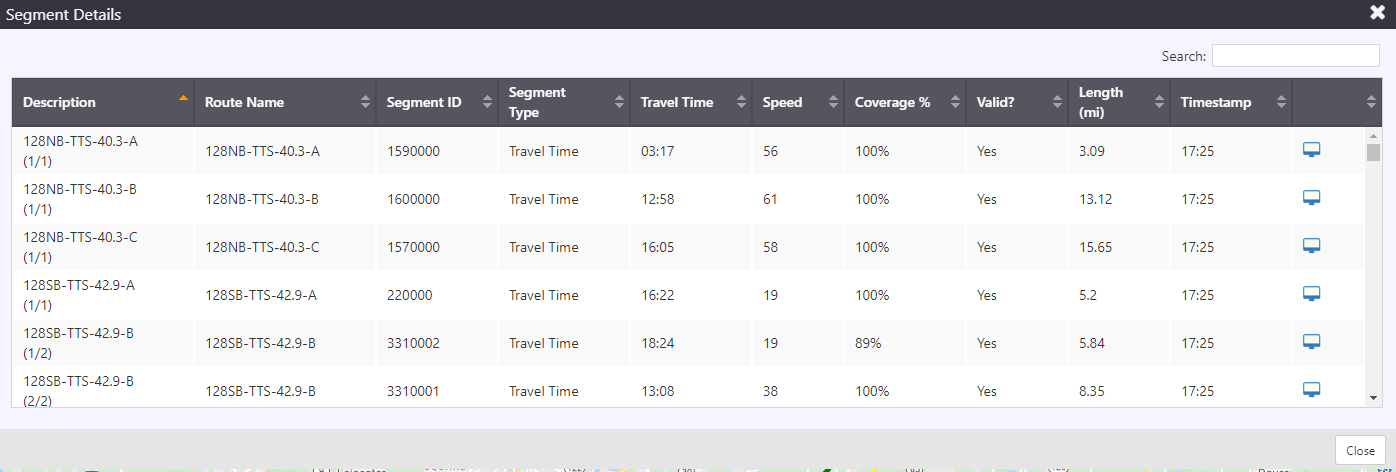
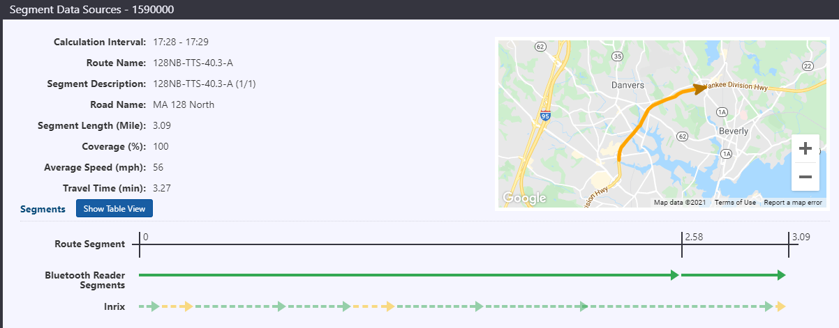
To view the individual road segments that make up a travel time route, open the travel time route list, click on the button for the desired route and select Segment Details. This view can be used to investigate which portions of a travel time route are causing reported delays, or which segments are causing a route to be invalid.
The Segment Details view provides:
- Travel Time: the current travel time of the segment
- Speed: the average speed of travel on the segment
- Coverage %: the percentage of the route that is covered by data sources that have reported data in their last collection interval
- Valid: indicates whether the segment is considered valid. To be valid, the Coverage % must be greater than a configurable threshold.
- Length: the length of the segment
- Timestamp: the time at which this segment data was recorded
Click on the detail icon to view the Segment Data Sources. The arrows represent the route's segments on the map.
Show or Hide a Travel Time Route on the Map
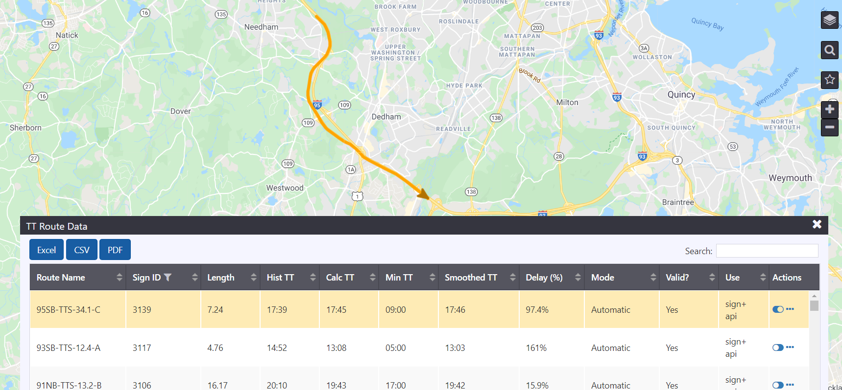
To display a travel time route on the map, open the TT Route Data list and, click on the button for the desired route. The icon will toggle to
and the selected travel time route will be visible on the map. Arrows representing each segment of the route are displayed on the map. The arrow indicates the direction of travel along the segment. Rows in the TT Route Data list representing routes that are currently displayed on the map are highlighted in orange.
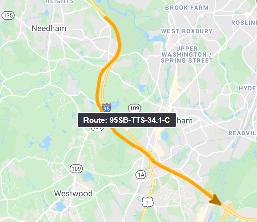
When a route is displayed on the map, users can hover the cursor over the route path to see hover text displaying the route name.
To hide a travel time route from the map, click on the button for the desired route. The icon will toggle to
and the selected travel time route will no longer be visible on the map. The arrows representing the route's segments are removed from the map, and the TT Route Data row is no longer highlighted.
Hide All Travel Time Routes
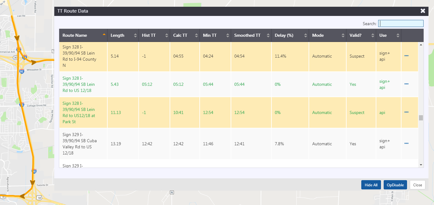
To hide all routes that are currently displayed on the map, click Hide All.
Disable or Enable a Travel Time Route
To Disable a Travel Time route, open the TT Route Data list, click on the button for the desired route and select Disable. The entry in the Mode column will switch to 'Disabled'. The ATMS continues to calculate travel times for disabled routes, but will not include them in travel time messages to signs or HAR.

To Enable a Travel Time route, open the TT Route Data list, click on the button for the desired route and select Enable. The entry in the Mode column will switch to 'Automatic' and will include the route in travel time messages to signs or HA